
Active Weather Continues January 5, 2021
 Active Weather Continues This Week
National Weather Service - Seattle, WA
Issued: Tue, Jan 05, 2021 - 04:12 AM
Next Update: 06 Jan 2021
Point of Contact: NWS Operations (24/7/365) 206-526-6095
KEY POINTS
● A weather system will move across the area today, bringing rain to the lowlands, snow to the mountains, high surf to the Coast, and gusty winds.
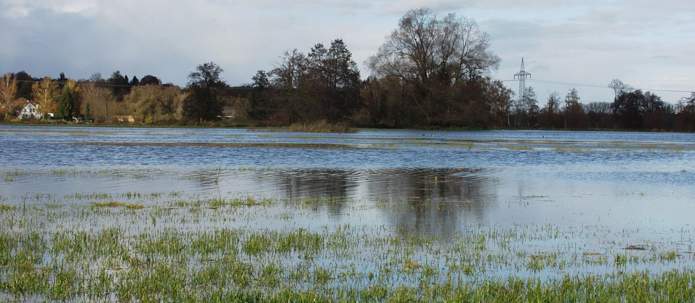
● Two rivers will remain above flood stage through most of this week - the Skokomish River near Potlatch and the Chehalis River at Porter and near Grand Mound. Renewed rises expected on other rivers, additional river flooding is not expected.
● Large waves near the Coast will create dangerous beach conditions this afternoon and tonight.
● Minor coastal flooding potential exists for areas along the interior coastline around Port Townsend this morning and from Olympia to Bellingham Wednesday morning with minor tidal overflow from King Tides.
CHANGES FROM PREVIOUS BRIEFING
● Wind forecast increased for the coast and interior north of Everett. See graphic for gusts.
● The forecast has trended wetter Friday and through the latter half of the weekend.
WEATHER AND IMPACT OUTLOOK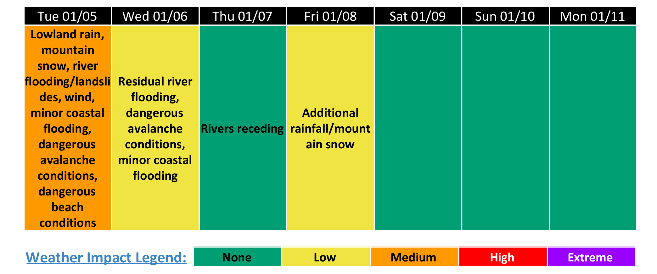
CONFINDENCE AND DETAILS
Western Washington (Below 3000 Feet)
HIGH Confidence
- River Flooding: Flooding along the Skokomish and Chehalis rivers is expected to cause road closures over the next several days.
- High Surf:Large waves will result in dangerous beach conditions this afternoon and tonight.
MODERATE Confidence
- Wind: Gusty winds today may result in power outages and tree damage, especially given saturated ground.
- Landslide Threat: Additional rainfall today will result in an increased threat of landslides.
- Urban Flooding: Additional roadway/urban flooding possible given recent heavy rainfall.
LOW Confindence
- Coastal Flooding: King Tides may combine with storm surge to result in minor coastal flooding this morning around Port Townsend and Wednesday morning from Olympia to Bellingham.
Forecast Details
- Today and Tonight
- A weather system will move across the area today and tonight.
- River flooding will continue along the Skokomish and Chehalis rivers. Renewed rises are expected on area rivers, but additional river flooding is not expected.
- Landslide threat will remain elevated given additional rainfall.
- Southerly winds will become gusty through this evening (see graphic for more details).
- Seas increasing to around 20 feet will create dangerous beach conditions (see graphic for more details).
- King Tides may combine with storm surge to create minor tidal overflow/coastal flooding conditions around Port Townsend this morning.
- Wednesday & Thursday
- Scattered showers, possibly a thunderstorm on Wednesday.
- Rivers will begin to recede, with lingering river flooding along the Skokomish and Chehalis Rivers.
- King Tides may combine with storm surge to create minor tidal overflow/coastal flooding conditions from Olympia to Bellingham Wednesday morning.
- Dry conditions Thursday.
- Friday-Weekend
- A weather system will move across the area Friday, bringing additional rainfall. Will continue to watch this system for impacts.
- Dry conditions most of Saturday.
- Another weather system possible on Sunday. Details remain uncertain at present time.
Cascades & Olympics Above 3000 Feet
High Confidence
- Mountain Snow: Heavy snow today and tonight will lead to travel delays and winter driving conditions across the Cascade passes.
- Avalanche Conditions: Dangerous avalanche conditions will continue for the Cascades through at least mid-week. See nwac.us for details.
Forecast Details
- Today and Tonight
- The next weather system will move across the area.
- Snow levels expected to remain between 2500-3500 feet.
- Heaviest snowfall is expected near the volcanoes, particularly Mount Baker and Mount Rainier where additional snowfall accumulations of between 1-2 feet is possible.
- Additional travel impacts possible.
- Dangerous avalanche conditions across the Cascades
- Wednesday and Thursday
- Scattered snow showers likely Wednesday. An isolated lightning strike cannot be ruled out
- Dry conditions Thursday
- Dangerous avalanche may continue
- Friday-Weekend
- A weather system will move across the area Friday, likely bringing more snow. Will continue to watch this system for impacts
- Dry conditions most of Saturday
- Another weather system possible on Sunday. Details remain uncertain at present time.
For the latest forecast updates, visit www.weather.gov/seattle.
Click here for additional information on current system